Understanding Groundwater
Geology, data, and planning for the future of New Mexico’s groundwater
Apr / 2024
Understanding New Mexico's Water Complexity
Sustaining life in a desert environment requires a nuanced and delicate balance between how much water we need and how much water is available. But that data hasn’t always been easy to find or easy to understand, especially for those of us who don’t have experience with data analysis (let's be real, that is most of us). That is changing, says Hobbs. "We're working towards a future where anyone, from researchers and policymakers to concerned citizens, can access the data they need to make informed decisions about our water resources." This is happening through The New Mexico Water Data Initiative.
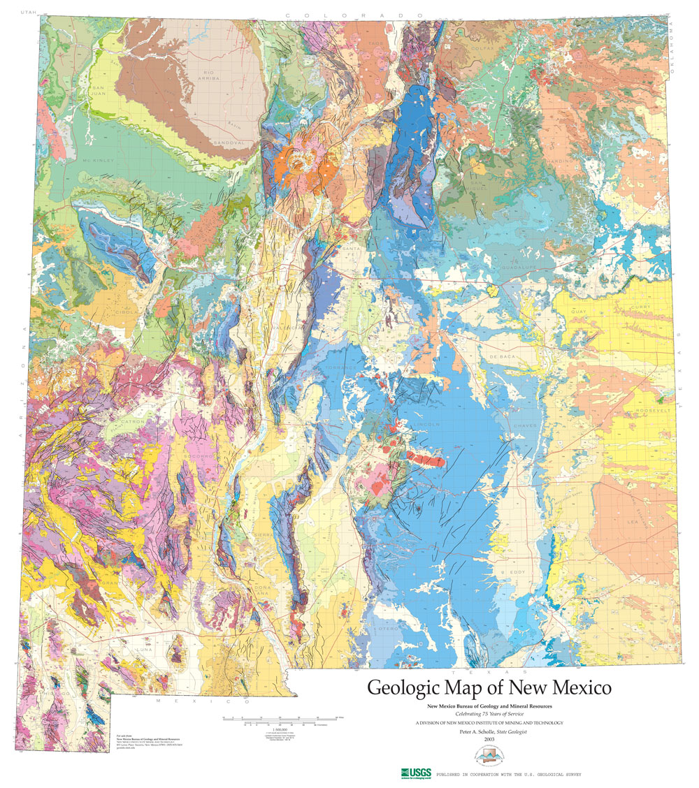
The Water Data Initiative got its start in 2019 with partners that include the New Mexico Bureau of Geology & Mineral Resources, the Office of the State Engineer and Interstate Stream Commission, the New Mexico Environment Department, and the New Mexico Energy, Minerals and Natural Resources Department. Together they are working to consolidate scattered data points into a centralized place for easy and accurate access.
The Initiative recently launched the New Mexico groundwater map, an interactive map that pulls data on groundwater measurements from federal, state, and municipal sources, showing where water levels are going up, staying steady, or declining. This groundwater map, which is still evolving, is a great example of how the Water Data Initiative is streamlining a wealth of information from various sources into an interactive and accessible tool, all in service to effective water planning.
Challenges and the Path Forward:
When it comes to groundwater, both Timmons and Hobbs are sure to note that New Mexico has challenges ahead. Many regions are observing declining water levels due to ongoing use of groundwater and slow recharge from drought conditions. Well drilling technology was nearly non-existent until the late 1940’s, but since that time roughly 2,000 wells have been drilled each year.
So what comes next? Timmons says the initiative is now working on a statewide water quality map. She says, “we want to make water quality data accessible, so no one has to hunt it down from 18 different places.” As the initiative continues, they will be expanding the toolset, following the data needs of water planning efforts across communities in New Mexico.
To learn more about the New Mexico Water Data Initiative and its catalog of data, visit newmexicowaterdata.org.